|
Greene
Ville Treaty
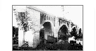
In 1795, 1,130 chiefs and warriors met in Fort Greene
Ville to make peace and to sign the Greene Ville Treaty giving all the lands south of
the Greene Ville Treaty Line, which bisected Shelby County, to the settlers and the lands
north of the line to the Indians.
The most important aspect of this treaty was that the northwest part of the Ohio
territory would belong to the Indians and the southern part would belong to the whites. It
ceded 16,930,417 acres and involved eleven northwestern Indian tribes. The Greene Ville
Treaty Line went through Shelby County, Ohio, starting a little south and west of Ft.
Loramie. Crossing from west to east, it entered at what is now McLean township and exited
at Salem township. This treaty signaled the beginning of real settlement activity for
Shelby County. 
As evidence of good faith, the Indian tribes ceded lands along the treaty line, with one
tract six miles square at or near Peter
Loramie’s store in Shelby County. The Indians were to receive $20,000 and a
perpetual annuity of $9,500. This treaty had more to do with the abandonment of Ohio for
lands and reservations beyond the Mississippi than anything else. The Greene Ville Treaty
was signed, by signature or mark, by many of the notables of the day, both Indian and
white leaders. A future, prominent, name absent from the document, unnoticed by the
American contingent, but of grave concern to Blackhoof and the other chiefs, was that of the Shawnee’s new rising star, Tecumseh.
As detailed in
A.B.C. Hitchcock’s "History of Shelby County," the substance of the treaty
is as follows: The boundary line established May 3, 1795, between the United States and
the Indians (Wyandots, Miamis, Delawares, Shawnees, Chippewas, Weas, Pottawatomies, Eel
Rivers, Kickapoos, Plankinshaws and Kaskaskias) began at the mouth of Cuyahoga river, and
thence up the same to the portage, between the Tuscarawas branch of the Muskingum (River);
thence down the branch to the crossing place above Fort Lawrence; thence westerly to a
fork of that branch of the Great Miami (River) running into the Ohio (River) at or near
which fork stood Loramie’s store, and where commenced the portage between the (Maumee
River) and the St. Mary's River...; thence a westerly course to Fort Recovery...;thence
southwesterly in a direct line to the Ohio (River) so as to intersect that river opposite
the mouth of the (Kentucky) River."
'Indian' segment written in December, 1997 by David Lodge
[ Back to Indians Index ]
|